
Lunda topographic map
Interactive map
Click on the map to display elevation.
About this map
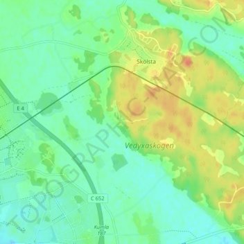
Name: Lunda topographic map, elevation, terrain.
Average elevation: 23 m
Minimum elevation: 8 m
Maximum elevation: 47 m
Other topographic maps
Click on a map to view its topography, its elevation and its terrain.
Lunda
Sweden > Uppsala County > Lunda
Lunda, Uppsala, Uppsala County, Region Svealand, 75449, Sweden
Average elevation: 30 m