
Thank you for supporting this site ❤️
Make a donation
Make a donation
Abertillery topographic map
Click on the map to display elevation.
Thank you for supporting this site ❤️
Make a donation
Make a donation
About this map
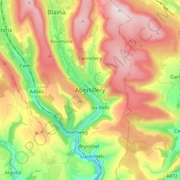
Name: Abertillery topographic map, elevation, terrain.
Location: Abertillery, Blaenau Gwent, Wales, NP13 1UJ, United Kingdom (51.68995 -3.17599 51.76995 -3.09599)
Average elevation: 354 m
Minimum elevation: 134 m
Maximum elevation: 575 m
Thank you for supporting this site ❤️
Make a donation
Make a donation
Other topographic maps
Click on a map to view its topography, its elevation and its terrain.