
Nagavali River topographic map
Interactive map
Click on the map to display elevation.
About this map
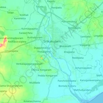
Name: Nagavali River topographic map, elevation, terrain.
Location: Nagavali River, Srikakulam, Andhra Pradesh, 532001, India (18.21026 83.86849 18.35108 83.94021)
Average elevation: 20 m
Minimum elevation: -1 m
Maximum elevation: 126 m