
Kingston topographic map
Interactive map
Click on the map to display elevation.
About this map
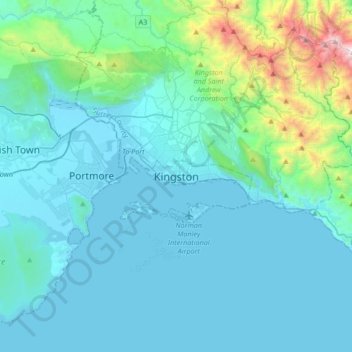
Name: Kingston topographic map, elevation, terrain.
Location: Kingston, Surrey County, KINGSTON 14, Jamaica (17.81121 -76.95281 18.13121 -76.63281)
Average elevation: 247 m
Minimum elevation: -3 m
Maximum elevation: 2,048 m