
Make a donation
Berlin topographic map
Click on the map to display elevation.
Make a donation
Berlin
Berlin straddles the banks of the Spree, which flows into the Havel (a tributary of the Elbe) in the western borough of Spandau. Among the city's main topographical features are the many lakes in the western and southeastern boroughs formed by the Spree, Havel and Dahme, the largest of which is Lake Müggelsee. About one-third of the city's area is composed of forests, parks, gardens, rivers, canals, and lakes. The city lies in the Central German dialect area, the Berlin dialect being spoken.
Make a donation
About this map
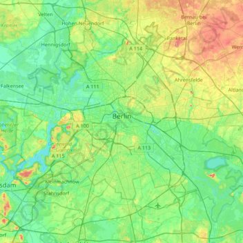
Name: Berlin topographic map, elevation, terrain.
Location: Berlin, Germany (52.33824 13.08835 52.67551 13.76116)
Average elevation: 48 m
Minimum elevation: 26 m
Maximum elevation: 112 m
Make a donation
Other topographic maps
Click on a map to view its topography, its elevation and its terrain.