
Denuy topographic map
Interactive map
Click on the map to display elevation.
About this map
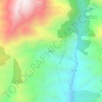
Name: Denuy topographic map, elevation, terrain.
Location: Denuy, Laspaúles, La Ribagorza, Huesca, Aragón, España (42.47702 0.61321 42.51702 0.65321)
Average elevation: 1,527 m
Minimum elevation: 1,062 m
Maximum elevation: 2,334 m
Other topographic maps
Click on a map to view its topography, its elevation and its terrain.