
La Corne à Bœuf topographic map
Interactive map
Click on the map to display elevation.
About this map
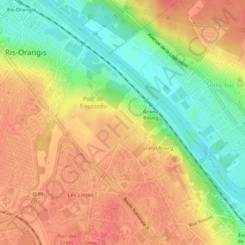
Name: La Corne à Bœuf topographic map, elevation, terrain.
Average elevation: 63 m
Minimum elevation: 29 m
Maximum elevation: 87 m
Other topographic maps
Click on a map to view its topography, its elevation and its terrain.
La Ferme du Temple
France > Île-de-France > Essonne > Ris-Orangis
La Ferme du Temple, Ris-Orangis, Arrondissement d'Évry, Essonne, Île-de-France, France métropolitaine, 91130, France
Average elevation: 71 m