
Kasama District topographic map
Interactive map
Click on the map to display elevation.
About this map
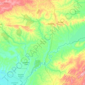
Name: Kasama District topographic map, elevation, terrain.
Location: Kasama District, Northern Province, Zambia (-11.33568 30.28481 -9.76509 31.54286)
Average elevation: 1,299 m
Minimum elevation: 1,166 m
Maximum elevation: 1,780 m
Other topographic maps
Click on a map to view its topography, its elevation and its terrain.