
Thank you for supporting this site ❤️
Make a donation
Make a donation
Dorkwerd topographic map
Click on the map to display elevation.
Thank you for supporting this site ❤️
Make a donation
Make a donation
About this map
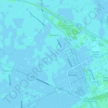
Name: Dorkwerd topographic map, elevation, terrain.
Location: Dorkwerd, Groningen, Nederland (53.23742 6.48043 53.25411 6.52092)
Average elevation: 1 m
Minimum elevation: -4 m
Maximum elevation: 4 m
Thank you for supporting this site ❤️
Make a donation
Make a donation
Other topographic maps
Click on a map to view its topography, its elevation and its terrain.