
魏家桥镇 topographic map
Interactive map
Click on the map to display elevation.
About this map
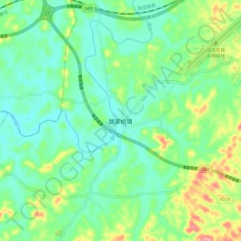
Name: 魏家桥镇 topographic map, elevation, terrain.
Location: 魏家桥镇, 邵东市, 邵阳市, 湖南省, 中国 (27.16060 111.59500 27.24060 111.67500)
Average elevation: 255 m
Minimum elevation: 220 m
Maximum elevation: 338 m
Other topographic maps
Click on a map to view its topography, its elevation and its terrain.