
Chunya topographic map
Interactive map
Click on the map to display elevation.
About this map
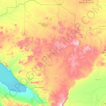
Name: Chunya topographic map, elevation, terrain.
Location: Chunya, Mbeya, Southern Highlands Zone, Tanzanie (-8.75505 31.97183 -6.90577 34.23427)
Average elevation: 1,249 m
Minimum elevation: 795 m
Maximum elevation: 2,665 m
Other topographic maps
Click on a map to view its topography, its elevation and its terrain.