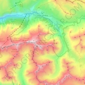
Villar-d'Arêne topographic map
Interactive map
Click on the map to display elevation.
About this map
Name: Villar-d'Arêne topographic map, elevation, terrain.
Average elevation: 2,539 m
Minimum elevation: 1,324 m
Maximum elevation: 3,933 m

Click on the map to display elevation.
Name: Villar-d'Arêne topographic map, elevation, terrain.
Average elevation: 2,539 m
Minimum elevation: 1,324 m
Maximum elevation: 3,933 m