
聂拉木县 topographic map
Interactive map
Click on the map to display elevation.
About this map
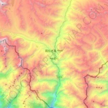
Name: 聂拉木县 topographic map, elevation, terrain.
Location: 聂拉木县, 聂拉木镇, 聂拉木县, 日喀则市, 西藏自治区, 中国 (27.99894 85.81998 28.31894 86.13998)
Average elevation: 4,756 m
Minimum elevation: 2,403 m
Maximum elevation: 6,969 m
Other topographic maps
Click on a map to view its topography, its elevation and its terrain.