
Randa topographic map
Interactive map
Click on the map to display elevation.
About this map
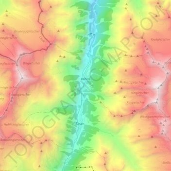
Name: Randa topographic map, elevation, terrain.
Location: Randa, Visp, Valais/Wallis, 3928, Switzerland (46.06479 7.68955 46.12600 7.86866)
Average elevation: 2,804 m
Minimum elevation: 1,211 m
Maximum elevation: 4,532 m