
Höckendorf topographic map
Interactive map
Click on the map to display elevation.
About this map
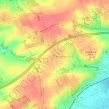
Name: Höckendorf topographic map, elevation, terrain.
Location: Höckendorf, Glauchau, Zwickau, Sachsen, Deutschland (50.82824 12.48564 50.84275 12.51085)
Average elevation: 281 m
Minimum elevation: 240 m
Maximum elevation: 306 m
Other topographic maps
Click on a map to view its topography, its elevation and its terrain.
Lipprandis
Deutschland > Sachsen > Zwickau > Glauchau
Lipprandis, Glauchau, Zwickau, Sachsen, Deutschland
Average elevation: 274 m