
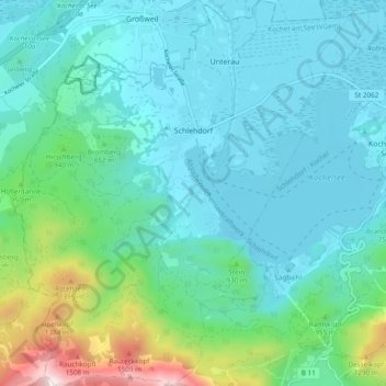
Schlehdorf topographic map
Interactive map
Click on the map to display elevation.
About this map
Name: Schlehdorf topographic map, elevation, terrain.
Average elevation: 802 m
Minimum elevation: 587 m
Maximum elevation: 1,760 m
Other topographic maps
Click on a map to view its topography, its elevation and its terrain.
Beuerberg
Germany > Bavaria > Landkreis Bad Tölz-Wolfratshausen
Beuerberg, Eurasburg, Landkreis Bad Tölz-Wolfratshausen, Bavaria, 82547, Germany
Average elevation: 618 m
Wegscheid
Germany > Bavaria > Landkreis Bad Tölz-Wolfratshausen > Lenggries
Wegscheid, Lenggries, Landkreis Bad Tölz-Wolfratshausen, Bavaria, 83661, Germany
Average elevation: 750 m
Kochel am See
Germany > Bavaria > Landkreis Bad Tölz-Wolfratshausen
Kochel am See, Kochel am See (VGem), Landkreis Bad Tölz-Wolfratshausen, Bavaria, Germany
Average elevation: 903 m
Geretsried
Germany > Bavaria > Landkreis Bad Tölz-Wolfratshausen > Geretsried
Geretsried, Landkreis Bad Tölz-Wolfratshausen, Bavaria, 82538, Germany
Average elevation: 616 m
Egling
Germany > Bavaria > Landkreis Bad Tölz-Wolfratshausen > Egling
Egling, Landkreis Bad Tölz-Wolfratshausen, Bavaria, 82544, Germany
Average elevation: 653 m
Benediktenwand
Germany > Bavaria > Landkreis Bad Tölz-Wolfratshausen > Benediktbeuern
Benediktenwand, Benediktbeuern, Benediktbeuern (VGem), Landkreis Bad Tölz-Wolfratshausen, Bavaria, Germany
Average elevation: 1,363 m
Wolfratshausen
Germany > Bavaria > Landkreis Bad Tölz-Wolfratshausen > Wolfratshausen
Wolfratshausen, Landkreis Bad Tölz-Wolfratshausen, Bavaria, 82515, Germany
Average elevation: 611 m
Lenggries
Germany > Bavaria > Landkreis Bad Tölz-Wolfratshausen
Lenggries, Landkreis Bad Tölz-Wolfratshausen, Bavaria, 83661, Germany
Average elevation: 1,096 m