
Sirchingen topographic map
Interactive map
Click on the map to display elevation.
About this map
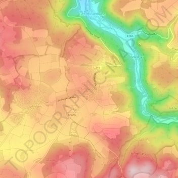
Name: Sirchingen topographic map, elevation, terrain.
Average elevation: 701 m
Minimum elevation: 472 m
Maximum elevation: 845 m
Other topographic maps
Click on a map to view its topography, its elevation and its terrain.
Eppenzillfelshöhle
Deutschland > Baden-Württemberg > Landkreis Reutlingen > Bad Urach
Eppenzillfelshöhle, Oberer Wasserfallweg, Bad Urach, Gemeindeverwaltungsverband Bad Urach, Landkreis Reutlingen, Baden-Württemberg, 72574, Deutschland
Average elevation: 678 m