
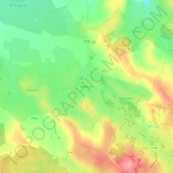
Bezonnes topographic map
Interactive map
Click on the map to display elevation.
About this map
Name: Bezonnes topographic map, elevation, terrain.
Average elevation: 567 m
Minimum elevation: 516 m
Maximum elevation: 625 m
Le village de Bezonnes se situe à 560 m d'altitude environ au cœur du Causse Comtal a 15 km au nord de Rodez au carrefour des routes départementales D27 et D68.
Other topographic maps
Click on a map to view its topography, its elevation and its terrain.
Les Coudols
France > Occitanie > Aveyron > Rodelle
Les Coudols, Rodelle, Rodez, Aveyron, Occitanie, France métropolitaine, 12340, France
Average elevation: 504 m