
Thank you for supporting this site ❤️
Make a donation
Make a donation
Carmeltown topographic map
Click on the map to display elevation.
Thank you for supporting this site ❤️
Make a donation
Make a donation
About this map
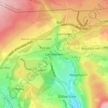
Name: Carmeltown topographic map, elevation, terrain.
Location: Carmeltown, Blaenau Gwent, Wales, NP23 5QE, United Kingdom (51.77690 -3.23628 51.81690 -3.19628)
Average elevation: 385 m
Minimum elevation: 272 m
Maximum elevation: 497 m
Thank you for supporting this site ❤️
Make a donation
Make a donation
Other topographic maps
Click on a map to view its topography, its elevation and its terrain.