
Thank you for supporting this site ❤️
Make a donation
Make a donation
Jūrmala topographic map
Click on the map to display elevation.
Thank you for supporting this site ❤️
Make a donation
Make a donation
About this map
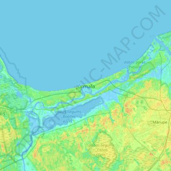
Name: Jūrmala topographic map, elevation, terrain.
Location: Jūrmala, Vidzeme, Latvia (56.81272 23.62870 57.13272 23.94870)
Average elevation: 4 m
Minimum elevation: -7 m
Maximum elevation: 23 m
Thank you for supporting this site ❤️
Make a donation
Make a donation