
Thank you for supporting this site ❤️
Make a donation
Make a donation
Stadtkyll topographic map
Click on the map to display elevation.
Thank you for supporting this site ❤️
Make a donation
Make a donation
About this map
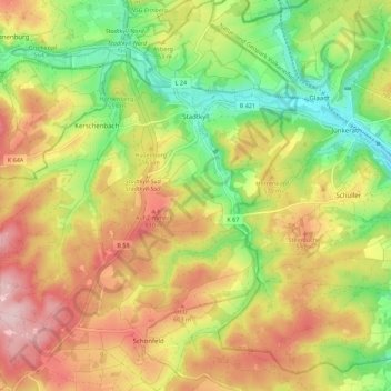
Name: Stadtkyll topographic map, elevation, terrain.
Average elevation: 541 m
Minimum elevation: 427 m
Maximum elevation: 661 m
Thank you for supporting this site ❤️
Make a donation
Make a donation
Other topographic maps
Click on a map to view its topography, its elevation and its terrain.
Hinterhausen
Germany > Rhineland-Palatinate > Landkreis Vulkaneifel > Gerolstein
Average elevation: 455 m
Thank you for supporting this site ❤️
Make a donation
Make a donation