
Leerdam topographic map
Interactive map
Click on the map to display elevation.
About this map
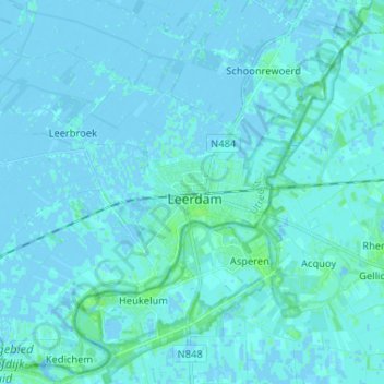
Name: Leerdam topographic map, elevation, terrain.
Location: Leerdam, Vijfheerenlanden, Utrecht, Nederland, 4141DA, Nederland (51.85374 5.05244 51.93374 5.13244)
Average elevation: 1 m
Minimum elevation: -3 m
Maximum elevation: 7 m