
Châteauroux topographic map
Interactive map
Click on the map to display elevation.
About this map
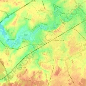
Name: Châteauroux topographic map, elevation, terrain.
Location: Châteauroux, Indre, Centro, França metropolitana, 36000, França (46.77480 1.63816 46.82975 1.74235)
Average elevation: 154 m
Minimum elevation: 133 m
Maximum elevation: 169 m