
Thank you for supporting this site ❤️
Make a donation
Make a donation
Cwmtillery topographic map
Click on the map to display elevation.
Thank you for supporting this site ❤️
Make a donation
Make a donation
About this map
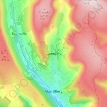
Name: Cwmtillery topographic map, elevation, terrain.
Location: Cwmtillery, Blaenau Gwent, Wales, NP13 1RB, United Kingdom (51.72406 -3.15602 51.76406 -3.11602)
Average elevation: 395 m
Minimum elevation: 188 m
Maximum elevation: 574 m
Thank you for supporting this site ❤️
Make a donation
Make a donation
Other topographic maps
Click on a map to view its topography, its elevation and its terrain.