Geolocate

卡纳 topographic map

Interactive map

Click on the map to display elevation.

About this map

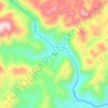
Name: 卡纳 topographic map, elevation, terrain.

Location: 卡纳, 丘北县, 文山壮族苗族自治州, 云南省, 中国 (23.99000 104.40400 24.03000 104.44400)

Average elevation: 1,461 m

Minimum elevation: 1,211 m

Maximum elevation: 1,778 m

Other topographic maps

Click on a map to view its topography, its elevation and its terrain.

普克

中国 > 云南省 > 丘北县

普克, 丘北县, 文山壮族苗族自治州, 云南省, 中国

Average elevation: 1,825 m

小龙潭

中国 > 云南省 > 丘北县

小龙潭, 丘北县, 文山壮族苗族自治州, 云南省, 中国

Average elevation: 1,396 m

龙潭

中国 > 云南省 > 丘北县

龙潭, 丘北县, 文山壮族苗族自治州, 云南省, 中国

Average elevation: 1,562 m

六桂

中国 > 云南省 > 丘北县

六桂, 丘北县, 文山壮族苗族自治州, 云南省, 中国

Average elevation: 1,444 m

五家寨

中国 > 云南省 > 丘北县

五家寨, 丘北县, 文山壮族苗族自治州, 云南省, 中国

Average elevation: 1,530 m