
Mill Run topographic map
Interactive map
Click on the map to display elevation.
About this map
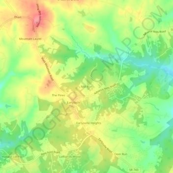
Name: Mill Run topographic map, elevation, terrain.
Average elevation: 177 m
Minimum elevation: 134 m
Maximum elevation: 222 m
Other topographic maps
Click on a map to view its topography, its elevation and its terrain.
Solaris
États-Unis d'Amérique > Virginie > Albemarle County
Solaris, Albemarle County, Virginie, 22923, États-Unis d'Amérique
Average elevation: 145 m