
Tam Đường topographic map
Interactive map
Click on the map to display elevation.
About this map
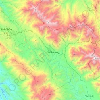
Name: Tam Đường topographic map, elevation, terrain.
Location: Tam Đường, Lai Châu, Vietnam (22.17463 103.41392 22.48669 103.78185)
Average elevation: 1,312 m
Minimum elevation: 183 m
Maximum elevation: 3,091 m
Other topographic maps
Click on a map to view its topography, its elevation and its terrain.