
Thank you for supporting this site ❤️
Make a donation
Make a donation
Anento topographic map
Click on the map to display elevation.
Thank you for supporting this site ❤️
Make a donation
Make a donation
About this map
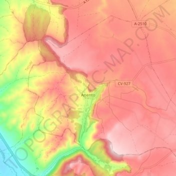
Name: Anento topographic map, elevation, terrain.
Location: Anento, Campo de Daroca, Zaragoza, Aragon, Spain (41.04794 -1.36013 41.09683 -1.28150)
Average elevation: 971 m
Minimum elevation: 783 m
Maximum elevation: 1,071 m
Thank you for supporting this site ❤️
Make a donation
Make a donation
Other topographic maps
Click on a map to view its topography, its elevation and its terrain.