
Thank you for supporting this site ❤️
Make a donation
Make a donation
Limulunga topographic map
Click on the map to display elevation.
Thank you for supporting this site ❤️
Make a donation
Make a donation
About this map
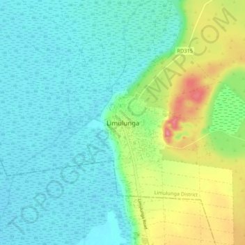
Name: Limulunga topographic map, elevation, terrain.
Location: Limulunga, Limulunga District, Western Province, Zambia (-15.16919 23.10755 -15.08919 23.18755)
Average elevation: 1,037 m
Minimum elevation: 1,015 m
Maximum elevation: 1,098 m
Thank you for supporting this site ❤️
Make a donation
Make a donation