
海城市 topographic map
Interactive map
Click on the map to display elevation.
About this map
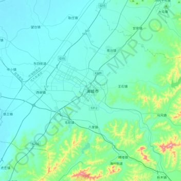
Name: 海城市 topographic map, elevation, terrain.
Location: 海城市, 鞍山市, 辽宁省, 中国 (40.69183 122.58333 41.01183 122.90333)
Average elevation: 59 m
Minimum elevation: 2 m
Maximum elevation: 476 m
Other topographic maps
Click on a map to view its topography, its elevation and its terrain.