
Laja topographic map
Interactive map
Click on the map to display elevation.
About this map
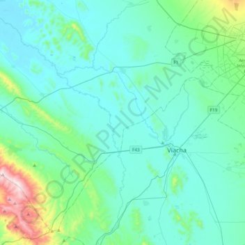
Name: Laja topographic map, elevation, terrain.
Location: Laja, Provincia Los Andes, La Paz, Bolívia (-16.77278 -68.61168 -16.45323 -68.23674)
Average elevation: 3,932 m
Minimum elevation: 3,818 m
Maximum elevation: 4,661 m