
Thank you for supporting this site ❤️
Make a donation
Make a donation
Mouillepied topographic map
Click on the map to display elevation.
Thank you for supporting this site ❤️
Make a donation
Make a donation
About this map
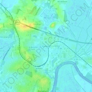
Name: Mouillepied topographic map, elevation, terrain.
Average elevation: 6 m
Minimum elevation: -2 m
Maximum elevation: 26 m
Thank you for supporting this site ❤️
Make a donation
Make a donation
Other topographic maps
Click on a map to view its topography, its elevation and its terrain.
17300
France > Nouvelle-Aquitaine > Charente-Maritime > Rochefort > Mouillepied
Average elevation: 4 m