
Kola topographic map
Interactive map
Click on the map to display elevation.
About this map
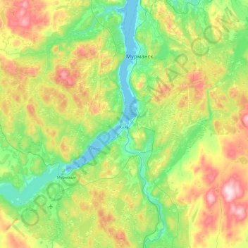
Name: Kola topographic map, elevation, terrain.
Average elevation: 146 m
Minimum elevation: -2 m
Maximum elevation: 478 m
Other topographic maps
Click on a map to view its topography, its elevation and its terrain.
Ленк
Russland > Oblast Murmansk > Rajon Kola
Ленк, сельское поселение Тулома, Rajon Kola, Oblast Murmansk, Föderationskreis Nordwest, Russland
Average elevation: 267 m