
Maseru topographic map
Interactive map
Click on the map to display elevation.
Maseru
Maseru is located in northwest Lesotho by the South African border, denoted by the Mohokare River. Mohokare River is also known as Caledon River. The two countries are connected by a border post at the Maseru Bridge, which crosses the river. On the South African side, Ladybrand is the town closest to Maseru. The city lies in a shallow valley at the foot of the Hlabeng-Sa-Likhama, foothills of the Maloti Mountains.[1] The elevation of the city is listed as 1,600 metres (5,200 ft) above sea level.[11] The city has an area of around 138 square kilometres (53 sq mi).[5]
About this map
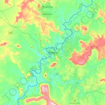
Name: Maseru topographic map, elevation, terrain.
Location: Maseru, Maseru District, 100, Lesotho (-29.47005 27.31822 -29.15005 27.63822)
Average elevation: 1,606 m
Minimum elevation: 1,460 m
Maximum elevation: 1,991 m