
Livonia topographic map
Interactive map
Click on the map to display elevation.
About this map
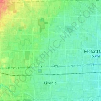
Name: Livonia topographic map, elevation, terrain.
Location: Livonia, Wayne County, Michigan, United States (42.35247 -83.43367 42.44203 -83.31283)
Average elevation: 201 m
Minimum elevation: 188 m
Maximum elevation: 238 m
Other topographic maps
Click on a map to view its topography, its elevation and its terrain.
Detroit
United States > Michigan > Wayne County
Detroit, Wayne County, Michigan, United States
Average elevation: 187 m
Dearborn Heights
United States > Michigan > Wayne County
Dearborn Heights, Wayne County, Michigan, United States
Average elevation: 190 m
Kresge Ford Basement Courtyard
United States > Michigan > Wayne County > Detroit
Kresge Ford Basement Courtyard, Art District, Midtown, Detroit, Wayne County, Michigan, United States
Average elevation: 193 m
Melvindale
United States > Michigan > Wayne County
Melvindale, Wayne County, Michigan, 48122, United States
Average elevation: 181 m
Van Buren Charter Township
United States > Michigan > Wayne County
Van Buren Charter Township, Wayne County, Michigan, 48111, United States
Average elevation: 208 m
Redford Charter Township
United States > Michigan > Wayne County
Redford Charter Township, Wayne County, Michigan, 48239, United States
Average elevation: 195 m
Newburg
United States > Michigan > Wayne County > Livonia
Newburg, Livonia, Wayne County, Michigan, 48150, United States
Average elevation: 209 m
Woodhaven
United States > Michigan > Wayne County
Woodhaven, Wayne County, Michigan, United States
Average elevation: 183 m
Belleville
United States > Michigan > Wayne County
Belleville, Wayne County, Michigan, United States
Average elevation: 205 m
Romulus
United States > Michigan > Wayne County
Romulus, Wayne County, Michigan, United States
Average elevation: 201 m
Dearborn
United States > Michigan > Wayne County
Dearborn, Wayne County, Michigan, United States
Average elevation: 184 m
Mamajuda Island
United States > Michigan > Wayne County > Grosse Ile Township
Mamajuda Island, Grosse Ile Township, Wayne County, Michigan, United States
Average elevation: 174 m
Allen Park
United States > Michigan > Wayne County > Allen Park
Allen Park, Wayne County, Michigan, 48101, United States
Average elevation: 183 m
Plymouth
United States > Michigan > Wayne County > Plymouth
Plymouth, Wayne County, Michigan, 48170, United States
Average elevation: 223 m
Dearborn
United States > Michigan > Wayne County > Dearborn
Dearborn, Wayne County, Michigan, 48126, United States
Average elevation: 190 m
Greenfield Village
United States > Michigan > Wayne County > Greenfield Village
Greenfield Village, Wayne County, Michigan, 48124‑5029, United States
Average elevation: 184 m
Taylor
United States > Michigan > Wayne County > Taylor
Taylor, Wayne County, Michigan, 48180, United States
Average elevation: 188 m
Sumpter Township
United States > Michigan > Wayne County > Sumpter Township
Sumpter Township, Wayne County, Michigan, United States
Average elevation: 201 m
Northville
United States > Michigan > Wayne County > Northville
Northville, Wayne County, Michigan, 48167, United States
Average elevation: 258 m
Lincoln Park
United States > Michigan > Wayne County
Lincoln Park, Wayne County, Michigan, 48146, United States
Average elevation: 180 m
Westland
United States > Michigan > Wayne County
Westland, Wayne County, Michigan, United States
Average elevation: 202 m