
San Roque topographic map
Interactive map
Click on the map to display elevation.
About this map
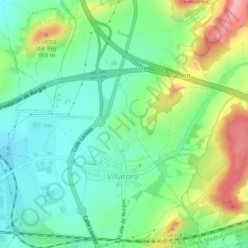
Name: San Roque topographic map, elevation, terrain.
Location: San Roque, Villatoro, Burgos, Castilla y León, 09006, España (42.37018 -3.70160 42.39018 -3.68160)
Average elevation: 893 m
Minimum elevation: 849 m
Maximum elevation: 976 m
Other topographic maps
Click on a map to view its topography, its elevation and its terrain.