
Village of Plover topographic map
Interactive map
Click on the map to display elevation.
About this map
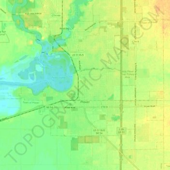
Name: Village of Plover topographic map, elevation, terrain.
Average elevation: 330 m
Minimum elevation: 315 m
Maximum elevation: 345 m
Other topographic maps
Click on a map to view its topography, its elevation and its terrain.
Stevens Point
United States > Wisconsin > Portage County
Stevens Point, Portage County, Wisconsin, United States
Average elevation: 335 m
Town of Buena Vista
United States > Wisconsin > Portage County
Town of Buena Vista, Portage County, Wisconsin, United States
Average elevation: 341 m
Amherst
United States > Wisconsin > Portage County
Amherst, Portage County, Wisconsin, United States
Average elevation: 328 m
Custer
United States > Wisconsin > Portage County
Custer, Town of Stockton, Portage County, Wisconsin, United States
Average elevation: 359 m
Polonia
United States > Wisconsin > Portage County
Polonia, Town of Sharon, Portage County, Wisconsin, 54423, United States
Average elevation: 368 m
Heffron
United States > Wisconsin > Portage County
Heffron, Town of Belmont, Portage County, Wisconsin, United States
Average elevation: 349 m
Dopp
United States > Wisconsin > Portage County
Dopp, Town of Belmont, Portage County, Wisconsin, United States
Average elevation: 313 m
Bancroft
United States > Wisconsin > Portage County
Bancroft, Town of Pine Grove, Portage County, Wisconsin, 54921, United States
Average elevation: 332 m
Almond
United States > Wisconsin > Portage County
Almond, Portage County, Wisconsin, United States
Average elevation: 354 m
Town of Almond
United States > Wisconsin > Portage County
Town of Almond, Portage County, Wisconsin, 54909, United States
Average elevation: 356 m
Town of Sharon
United States > Wisconsin > Portage County
Town of Sharon, Portage County, Wisconsin, 54423, United States
Average elevation: 357 m
Amherst Junction
United States > Wisconsin > Portage County
Amherst Junction, Portage County, Wisconsin, United States
Average elevation: 341 m
Rosholt
United States > Wisconsin > Portage County
Rosholt, Portage County, Wisconsin, United States
Average elevation: 351 m