
Vlaas topographic map
Interactive map
Click on the map to display elevation.
About this map
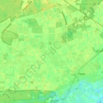
Name: Vlaas topographic map, elevation, terrain.
Location: Vlaas, Neer, Leudal, Limburg, Nederland, 6086, Nederland (51.25073 5.94924 51.29073 5.98924)
Average elevation: 29 m
Minimum elevation: 17 m
Maximum elevation: 38 m