
confluence of Red River of the North and Buffalo River topographic map
Interactive map
Click on the map to display elevation.
About this map
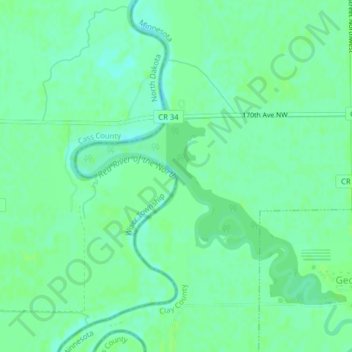
Name: confluence of Red River of the North and Buffalo River topographic map, elevation, terrain.
Average elevation: 268 m
Minimum elevation: 263 m
Maximum elevation: 271 m
Other topographic maps
Click on a map to view its topography, its elevation and its terrain.
Dilworth
United States > Minnesota > Clay County
Dilworth, Clay County, Minnesota, 56529, United States
Average elevation: 278 m
Comstock
United States > Minnesota > Clay County
Comstock, Clay County, Minnesota, 56525, United States
Average elevation: 281 m
Hitterdal
United States > Minnesota > Clay County
Hitterdal, Clay County, Minnesota, United States
Average elevation: 379 m
Georgetown
United States > Minnesota > Clay County
Georgetown, Clay County, Minnesota, United States
Average elevation: 269 m
Baker
United States > Minnesota > Clay County
Baker, Clay County, Minnesota, United States
Average elevation: 286 m
Hitterdahl WMA
United States > Minnesota > Clay County
Hitterdahl WMA, 270th Street North, Clay County, Minnesota, 56552, United States
Average elevation: 379 m
Sabin
United States > Minnesota > Clay County
Sabin, Clay County, Minnesota, United States
Average elevation: 282 m
Glyndon
United States > Minnesota > Clay County
Glyndon, Clay County, Minnesota, 56547, United States
Average elevation: 282 m
Moorhead
United States > Minnesota > Clay County
Moorhead, Clay County, Minnesota, United States
Average elevation: 277 m
Kragnes
United States > Minnesota > Clay County
Kragnes, Clay County, Minnesota, United States
Average elevation: 273 m
Ulen
United States > Minnesota > Clay County
Ulen, Clay County, Minnesota, 56585, United States
Average elevation: 352 m
Moorhead
United States > Minnesota > Clay County > Moorhead > Moorhead
Moorhead, Clay County, Minnesota, 56563, United States
Average elevation: 277 m
Barnesville
United States > Minnesota > Clay County
Barnesville, Clay County, Minnesota, 56514, United States
Average elevation: 311 m
Felton
United States > Minnesota > Clay County
Felton, Clay County, Minnesota, United States
Average elevation: 279 m
Hawley
United States > Minnesota > Clay County
Hawley, Clay County, Minnesota, United States
Average elevation: 356 m