
Hayden topographic map
Interactive map
Click on the map to display elevation.
About this map
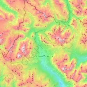
Name: Hayden topographic map, elevation, terrain.
Location: Hayden, Belluno, Venetien, 32043, Italien (46.46177 11.98854 46.67498 12.25759)
Average elevation: 1,974 m
Minimum elevation: 972 m
Maximum elevation: 3,206 m
Other topographic maps
Click on a map to view its topography, its elevation and its terrain.
Gruppo del Pomagagnon
Italien > Venetien > Belluno > Hayden
Gruppo del Pomagagnon, Hayden, Belluno, Venetien, 32043, Italien
Average elevation: 1,758 m