
Thank you for supporting this site ❤️
Make a donation
Make a donation
Tatong topographic map
Click on the map to display elevation.
Thank you for supporting this site ❤️
Make a donation
Make a donation
About this map
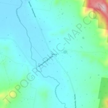
Name: Tatong topographic map, elevation, terrain.
Location: Tatong, Rural City of Benalla, Victoria, 3673, Australia (-36.75031 146.08857 -36.71031 146.12857)
Average elevation: 272 m
Minimum elevation: 215 m
Maximum elevation: 550 m
Thank you for supporting this site ❤️
Make a donation
Make a donation
Other topographic maps
Click on a map to view its topography, its elevation and its terrain.