
Candarave topographic map
Interactive map
Click on the map to display elevation.
About this map
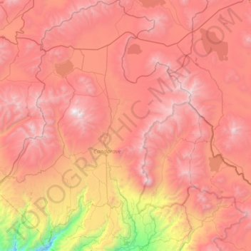
Name: Candarave topographic map, elevation, terrain.
Location: Candarave, Province of Candarave, Tacna, Peru (-17.34191 -70.46502 -16.77043 -70.06989)
Average elevation: 4,445 m
Minimum elevation: 2,468 m
Maximum elevation: 5,798 m