
Lawrenceville topographic map
Interactive map
Click on the map to display elevation.
About this map
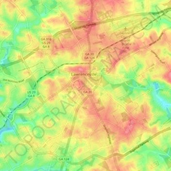
Name: Lawrenceville topographic map, elevation, terrain.
Location: Lawrenceville, Gwinnett County, Georgia, USA (33.91212 -84.04614 33.99066 -83.95236)
Average elevation: 312 m
Minimum elevation: 268 m
Maximum elevation: 346 m