
Pastoral Unincorporated Area topographic map
Interactive map
Click on the map to display elevation.
About this map
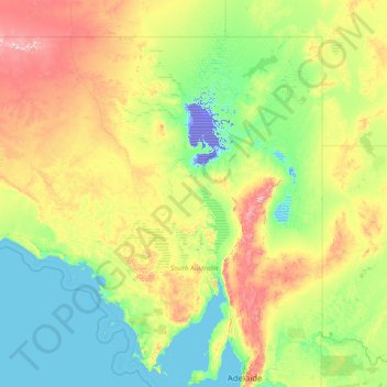
Name: Pastoral Unincorporated Area topographic map, elevation, terrain.
Location: Pastoral Unincorporated Area, South Australia, Australia (-34.39731 129.00192 -25.99639 141.00274)
Average elevation: 135 m
Minimum elevation: -16 m
Maximum elevation: 1,213 m
Other topographic maps
Click on a map to view its topography, its elevation and its terrain.
Brompton
Brompton, City of Charles Sturt, South Australia, 5007, Australia
Average elevation: 24 m
Kati Thanda-Lake Eyre (North)
Kati Thanda-Lake Eyre (North), Lake Eyre, Pastoral Unincorporated Area, South Australia, 5733, Australia
Average elevation: 2 m