
Gundeldingen topographic map
Interactive map
Click on the map to display elevation.
About this map
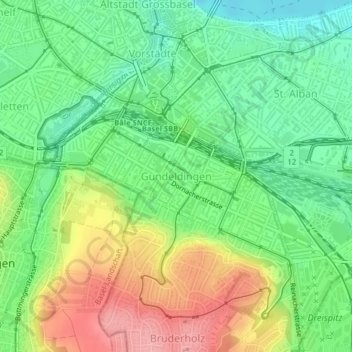
Name: Gundeldingen topographic map, elevation, terrain.
Location: Gundeldingen, Basel, Basel-City, Switzerland (47.53678 7.57828 47.54959 7.60426)
Average elevation: 295 m
Minimum elevation: 249 m
Maximum elevation: 363 m