
Lincoln topographic map
Interactive map
Click on the map to display elevation.
About this map
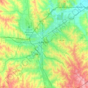
Name: Lincoln topographic map, elevation, terrain.
Location: Lincoln, Lancaster County, Nebraska, USA (40.69377 -96.80415 40.90028 -96.57731)
Average elevation: 378 m
Minimum elevation: 342 m
Maximum elevation: 447 m