
Celle Ligure topographic map
Interactive map
Click on the map to display elevation.
About this map
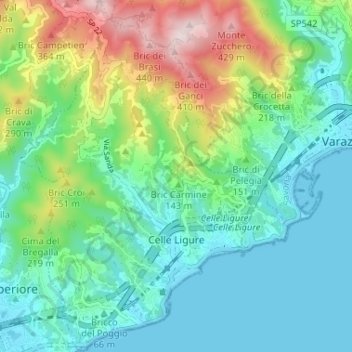
Name: Celle Ligure topographic map, elevation, terrain.
Location: Celle Ligure, SV, Liguria, Italy (44.33148 8.51536 44.37793 8.56520)
Average elevation: 120 m
Minimum elevation: -2 m
Maximum elevation: 445 m