
Arwandop topographic map
Interactive map
Click on the map to display elevation.
About this map
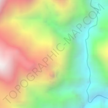
Name: Arwandop topographic map, elevation, terrain.
Location: Arwandop, Papua, Indonesia (-4.17375 136.78076 -4.15375 136.80076)
Average elevation: 1,389 m
Minimum elevation: 743 m
Maximum elevation: 2,124 m
Other topographic maps
Click on a map to view its topography, its elevation and its terrain.