
Thank you for supporting this site ❤️
Make a donation
Make a donation
Ambattur topographic map
Click on the map to display elevation.
Thank you for supporting this site ❤️
Make a donation
Make a donation
About this map
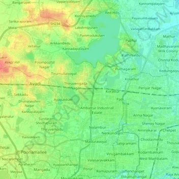
Name: Ambattur topographic map, elevation, terrain.
Location: Ambattur, Thiruvallur District, Tamil Nadu, India (13.02166 80.02890 13.20498 80.20238)
Average elevation: 18 m
Minimum elevation: 1 m
Maximum elevation: 53 m
Thank you for supporting this site ❤️
Make a donation
Make a donation
Other topographic maps
Click on a map to view its topography, its elevation and its terrain.