
Thank you for supporting this site ❤️
Make a donation
Make a donation
Umgeni River topographic map
Click on the map to display elevation.
Thank you for supporting this site ❤️
Make a donation
Make a donation
About this map
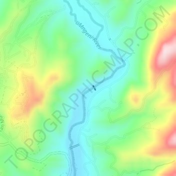
Name: Umgeni River topographic map, elevation, terrain.
Average elevation: 360 m
Minimum elevation: 248 m
Maximum elevation: 576 m
Thank you for supporting this site ❤️
Make a donation
Make a donation
Other topographic maps
Click on a map to view its topography, its elevation and its terrain.
Msinga Local Municipality
South Africa > KwaZulu-Natal > Umzinyathi District Municipality
Average elevation: 1,032 m
Thank you for supporting this site ❤️
Make a donation
Make a donation
Mtubatuba
South Africa > KwaZulu-Natal > Umkhanyakude District Municipality > Mtubatuba Local Municipality
Average elevation: 64 m